


Voting District 64, Pontotoc County, Oklahoma
About
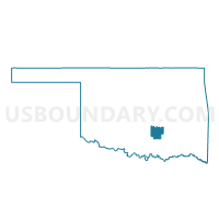
Outline

Summary
| Unique Area Identifier | 655046 |
| Name | Voting District 64 |
| County | Pontotoc County |
| State | Oklahoma |
| Area (square miles) | 82.16 |
| Land Area (square miles) | 81.73 |
| Water Area (square miles) | 0.43 |
| % of Land Area | 99.47 |
| % of Water Area | 0.53 |
| Latitude of the Internal Point | 34.77560060 |
| Longtitude of the Internal Point | -96.49142610 |
Maps


Graphs
Select a template below for downloading or customizing gragh for Voting District 64, Pontotoc County, Oklahoma


Neighbors
Neighoring Voting District (by Name) Neighboring Voting District on the Map
- Voting District 25, Pontotoc County, OK
- Voting District 34, Hughes County, OK
- Voting District 51, Pontotoc County, OK
- Voting District 53, Pontotoc County, OK
- Voting District 56, Pontotoc County, OK
- Voting District 61, Pontotoc County, OK
- Voting District 8, Coal County, OK
Top 10 Neighboring County Subdivision (by Population) Neighboring County Subdivision on the Map
- Ada CCD, Pontotoc County, OK (23,147)
- Northeast Pontotoc CCD, Pontotoc County, OK (5,135)
- South Hughes CCD, Hughes County, OK (2,444)
- Southeast Pontotoc CCD, Pontotoc County, OK (2,417)
- West Coal CCD, Coal County, OK (1,908)
Top 10 Neighboring Place (by Population) Neighboring Place on the Map
Top 10 Neighboring Unified School District (by Population) Neighboring Unified School District on the Map
- Byng Public Schools, OK (8,550)
- Stonewall Public Schools, OK (3,209)
- Allen Public Schools, OK (2,319)
- Tupelo Public Schools, OK (1,119)
Top 10 Neighboring State Legislative District Lower Chamber (by Population) Neighboring State Legislative District Lower Chamber on the Map
Top 10 Neighboring State Legislative District Upper Chamber (by Population) Neighboring State Legislative District Upper Chamber on the Map
Top 10 Neighboring 111th Congressional District (by Population) Neighboring 111th Congressional District on the Map
Top 10 Neighboring Census Tract (by Population) Neighboring Census Tract on the Map
- Census Tract 888, Pontotoc County, OK (7,316)
- Census Tract 886, Pontotoc County, OK (5,135)
- Census Tract 4850, Hughes County, OK (2,444)
- Census Tract 887, Pontotoc County, OK (2,417)
- Census Tract 3882, Coal County, OK (1,908)